


Lenox Precinct 1, Berkshire County, Massachusetts
About
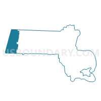
Outline

Summary
| Unique Area Identifier | 593677 |
| Name | Lenox Precinct 1 |
| County | Berkshire County |
| State | Massachusetts |
| Area (square miles) | 21.67 |
| Land Area (square miles) | 21.22 |
| Water Area (square miles) | 0.45 |
| % of Land Area | 97.92 |
| % of Water Area | 2.08 |
| Latitude of the Internal Point | 42.36786150 |
| Longtitude of the Internal Point | -73.26976800 |
Maps


Graphs
Select a template below for downloading or customizing gragh for Lenox Precinct 1, Berkshire County, Massachusetts


Neighbors
Neighoring Voting District (by Name) Neighboring Voting District on the Map
- Lee Precinct 1, Berkshire County, MA
- Lee Precinct 6, Berkshire County, MA
- Pittsfield Ward 4 Precinct A, Berkshire County, MA
- Pittsfield Ward 4 Precinct B, Berkshire County, MA
- Pittsfield Ward 5 Precinct B, Berkshire County, MA
- Richmond Precinct 1, Berkshire County, MA
- Stockbridge Precinct 1, Berkshire County, MA
- Washington Precinct 1, Berkshire County, MA
Top 10 Neighboring County Subdivision (by Population) Neighboring County Subdivision on the Map
- Pittsfield city, Berkshire County, MA (44,737)
- Lee town, Berkshire County, MA (5,943)
- Lenox town, Berkshire County, MA (5,025)
- Stockbridge town, Berkshire County, MA (1,947)
- Richmond town, Berkshire County, MA (1,475)
- Washington town, Berkshire County, MA (538)
Top 10 Neighboring Place (by Population) Neighboring Place on the Map
Top 10 Neighboring Elementary School District (by Population) Neighboring Elementary School District on the Map
Top 10 Neighboring Secondary School District (by Population) Neighboring Secondary School District on the Map
Top 10 Neighboring Unified School District (by Population) Neighboring Unified School District on the Map
- Pittsfield School District, MA (44,737)
- Central Berkshire School District, MA (13,723)
- Berkshire Hills School District, MA (10,357)
- Lee School District, MA (6,270)
- Lenox School District, MA (5,025)
Top 10 Neighboring State Legislative District Lower Chamber (by Population) Neighboring State Legislative District Lower Chamber on the Map
- Second Berkshire District, MA (40,125)
- Third Berkshire District, MA (38,397)
- Fourth Berkshire District, MA (37,775)
Top 10 Neighboring State Legislative District Upper Chamber (by Population) Neighboring State Legislative District Upper Chamber on the Map
Top 10 Neighboring 111th Congressional District (by Population) Neighboring 111th Congressional District on the Map
Top 10 Neighboring Census Tract (by Population) Neighboring Census Tract on the Map
- Census Tract 9141, Berkshire County, MA (5,943)
- Census Tract 9131, Berkshire County, MA (5,025)
- Census Tract 9008, Berkshire County, MA (4,835)
- Census Tract 9351, Berkshire County, MA (2,420)
- Census Tract 9322, Berkshire County, MA (2,317)
- Census Tract 9241, Berkshire County, MA (1,947)
Top 10 Neighboring 5-Digit ZIP Code Tabulation Area (by Population) Neighboring 5-Digit ZIP Code Tabulation Area on the Map
- 01201, MA (46,504)
- 01238, MA (6,047)
- 01240, MA (4,534)
- 01266, MA (1,463)
- 01262, MA (1,238)
- 01254, MA (972)
- 01242, MA (476)